Austria - Hungary 1890 Facsimile Historic Map 1:1 500 000


Austria - Hungary 1890 Facsimile Historic Map 1:1 500 000
Regular price
Checking stock...
Regular price
Checking stock...
The feel-good place to buy books
- Free UK delivery over £5
- 10% off preloved books when you join +Plus
- Buying preloved emits 46% less CO2 than new
- Give your books a new home - sell them back to us!
Austria - Hungary 1890 Facsimile Historic Map 1:1 500 000 by Freytag And Berndt
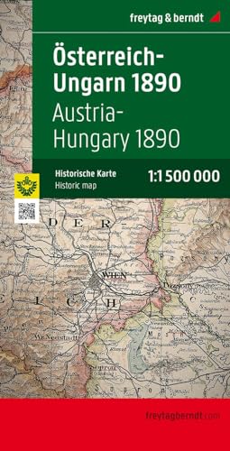
A historical map of Austria and Hungary (Monarchy map 1890) - A facsimile edition of the official map of the empire made by the then court cartographer Gustav Freytag on a scale of 1: 1 500 000, The map shows internal political units within the double monarchy, of Bohemia , Moravia, Silesia and Galicia in the north to Bosnia and Herzegovina in the south, including the neighboring areas in the Balkans, The railway lines are also indicated, with signed relief and numerous geographical names.| SKU | Unavailable |
| ISBN 13 | 9783707912722 |
| ISBN 10 | 3707912728 |
| Title | Austria - Hungary 1890 Facsimile Historic Map 1:1 500 000 |
| Author | Freytag And Berndt |
| Condition | Unavailable |
| Publisher | Freytag-Berndt |
| Year published | 2009-08-01 |
| Cover note | Book picture is for illustrative purposes only, actual binding, cover or edition may vary. |
| Note | Unavailable |