Austria - Hungary 1890 Facsimile Historic Map 1:1 500 000


Austria - Hungary 1890 Facsimile Historic Map 1:1 500 000
Regular price
Checking stock...
Regular price
Checking stock...
Summary
freytag & berndt maps are available for many countries and regions in the world. In addition to the precise cartography each map also includes a lot of additional information about the region covered.
The feel-good place to buy books
- Free delivery in Ireland
- Supporting authors with AuthorSHARE
- 100% recyclable packaging
- Proud to be a B Corp – A Business for good
- Buy-back with Ziffit
Austria - Hungary 1890 Facsimile Historic Map 1:1 500 000 by Freytag And Berndt
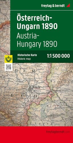
A historical map of Austria and Hungary (Monarchy map 1890) - A facsimile edition of the official map of the empire made by the then court cartographer Gustav Freytag on a scale of 1: 1 500 000, The map shows internal political units within the double monarchy, of Bohemia , Moravia, Silesia and Galicia in the north to Bosnia and Herzegovina in the south, including the neighboring areas in the Balkans, The railway lines are also indicated, with signed relief and numerous geographical names.| SKU | Unavailable |
| ISBN 13 | 9783707912722 |
| ISBN 10 | 3707912728 |
| Title | Austria - Hungary 1890 Facsimile Historic Map 1:1 500 000 |
| Author | Freytag And Berndt |
| Condition | Unavailable |
| Publisher | Freytag-Berndt |
| Year published | 2009-08-01 |
| Cover note | Book picture is for illustrative purposes only, actual binding, cover or edition may vary. |
| Note | Unavailable |